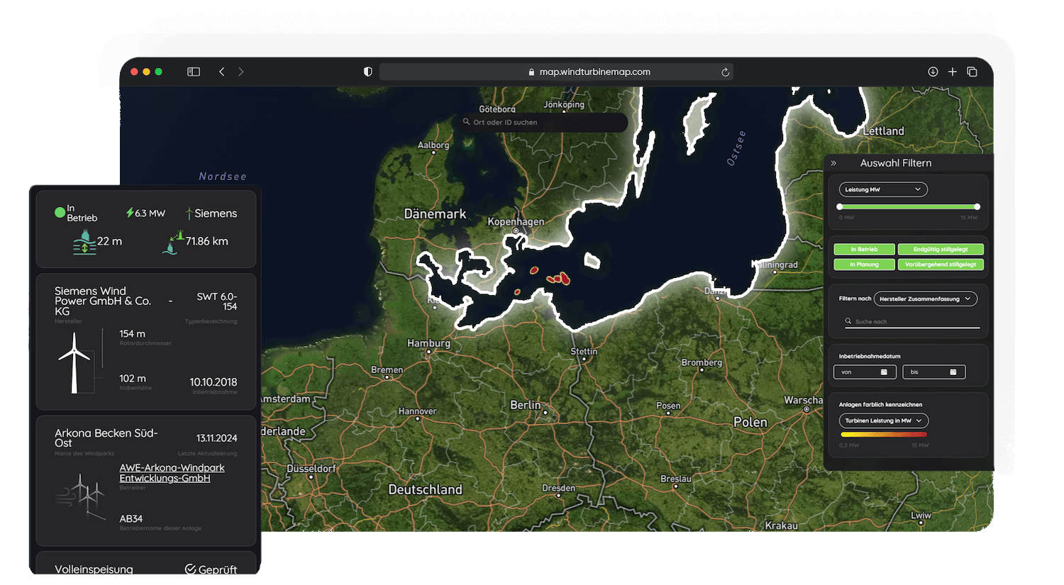
The German Baltic Sea is a growing location for offshore wind power - characterized by limited space, calmer sea areas and short distances to the coast. Our map shows all existing and planned offshore wind farms in the Baltic Sea - visually, data-based and user-friendly.
The map is based on publicly accessible data, primarily from the market master data register. We have specifically cleansed, geographically specified and structured the information in order to provide a clear overview of wind power development in the Baltic Sea - without a flood of data, but with substance.
Fernsteuerbarkeit Direktvermarkter
Nachtkennzeichung (BNK)
Eiswurf Abschaltung
Rotorblatt-enteisung
Prototyp
Tierschutz Abschaltung
Bürgerenergie
Schattenwurf Abschaltung
Nacht Abschaltung
Pilotanlage
Schallimmissions-schutz
Einsatz-verantwortlicher
Sonstige Abschaltung
with extensive data depth
+1
Planned offshore facilities
Planned offshore wind turbines in the Baltic Sea - clearly visualized and easy to filter according to your criteria.
+ 0
Existing wind turbines
All offshore turbines in operation in the Baltic Sea - including location data, turbine type, output and commissioning. Regularly updated and clearly structured.
Focus on the North Sea
Analyze offshore wind farms - data-based & clear
WindTurbineMap makes offshore wind visible and understandable: each dot on the map represents a wind turbine - including operator, technology and status. Our platform offers more than just a map view: it provides access to a clearly structured database for planning, analysis and exchange.
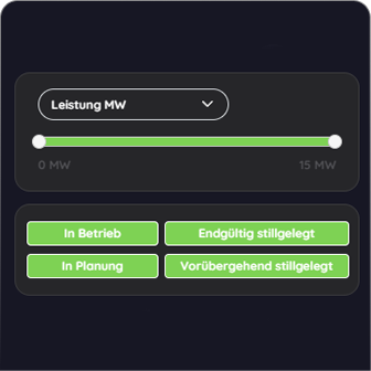
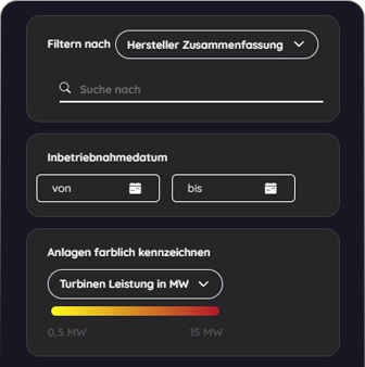
Filter. Compare. Benefit.
Offshore data from the North Sea - simple filtering, targeted use
Targeted filtering - easy to find
Search specifically for wind turbines in the German Baltic Sea.